Earth's Longest Straight Line Spans 32,000 km Ocean
3 months ago
-- ADVERTISEMENT --
A remarkable maritime route stretches 32,000 kilometers across Earth's oceans without touching land, yet appears curved on traditional maps. Discover how geography and cartography reveal this stunning natural wonder.
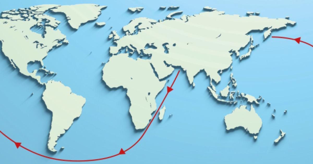
Imagine a voyage that challenges everything we think we know about navigation and maps. The world's longest navigable straight line extends approximately 32,089 kilometers across Earth's oceans, connecting four different seas without ever touching a continent or significant island. Yet when plotted on a standard map, this incredible route appears anything but straight—a fascinating paradox that reveals the hidden complexities of our planet.
This remarkable journey begins along the southern coast of Pakistan and extends all the way to Russia's Kamchatka Peninsula in the far east. The route traverses the Indian Ocean, the South Atlantic, the South Pacific, and the Pacific Ocean in perfect geometric alignment when measured on Earth's actual spherical surface. For adventurers and maritime enthusiasts, this represents an extraordinary path across four of our planet's greatest waters.
Researchers Rohan Chabukswar and Kushal Mukherjee made this groundbreaking discovery using a specialized algorithm based on branch-and-bound computational techniques. Their sophisticated mathematical approach calculated the longest possible continuous routes across open ocean, ultimately confirming that the Pakistan-to-Russia passage holds the distinction of being the world's longest unobstructed maritime line.
-- ADVERTISEMENT --
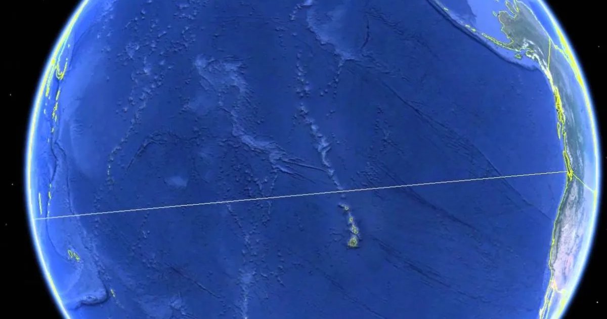
The mystery of why this perfectly straight line appears curved on maps holds a beautiful explanation: Earth itself is round. When cartographers project our spherical planet onto a flat map, distances and shapes inevitably distort, particularly across such vast distances. What appears as a curve on paper is actually a perfectly straight path across our globe's curved surface.
This phenomenon teaches us something important about perspective. Routes that look shorter or more direct on traditional maps may actually be longer in reality. The longest navigable straight line—stretching from the Indian subcontinent to Russia's far eastern reaches—beautifully demonstrates how our perception shifts when we consider Earth's true geometry.
Beyond satisfying geographic curiosity, this research has practical applications that matter. Understanding these oceanic pathways helps optimize maritime transportation routes, supports efficient shipping logistics, and deepens our appreciation for how geography shapes global commerce and exploration.
-- ADVERTISEMENT --
Source: diariouno.com.ar